Coadan:The Street.jpg
Cha nel jeeskeaylley ny smoo ry-gheddyn.
The_Street.jpg (640 × 431 pixel, mooadys y choadan: 107 KB, sorçh MIME: image/jpeg)
Giare-choontey
| Coontey |
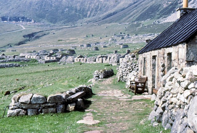
English: The Street, St Kilda You can see the quarry in the distance. It was used extensively by the military to provide materials for the building of their garrison on the island. |
| Date | |
| Bun | From geograph.org.uk |
| Author | Des Colhoun |
| Attribution (required by the license) | Des Colhoun / The Street, St Kilda / |
| Camera location | | View this and other nearby images on: OpenStreetMap |
|---|
Kieddagh:

|
This image was taken from the Geograph project collection. See this photograph's page on the Geograph website for the photographer's contact details. The copyright on this image is owned by Des Colhoun and is licensed for reuse under the Creative Commons Attribution-ShareAlike 2.0 license.
|
This file is licensed under the Creative Commons Attribution-Share Alike 2.0 Generic license.
Attribution: Des Colhoun
- You are free:
- to share – to copy, distribute and transmit the work
- to remix – to adapt the work
- Under the following conditions:
- attribution – You must give appropriate credit, provide a link to the license, and indicate if changes were made. You may do so in any reasonable manner, but not in any way that suggests the licensor endorses you or your use.
- share alike – If you remix, transform, or build upon the material, you must distribute your contributions under the same or compatible license as the original.
Shennaghys y choadan
Crig er daayt/am ennagh son fakin er y choadan myr v’eh ec y traa shen.
| Daayt/Am | Ingin-ordaag | Towshanyn | Ymmydeyr | Cohaggloo | |
|---|---|---|---|---|---|
| bio | 09:48, 3 Jerrey Geuree 2009 | | 640 × 431 (107 KB) | Philippe Giabbanelli | {{Information |Description={{en|1=You can see the quarry in the distance. It was used extensively by the military to provide materials for the building of their garrison on the island.}} |Source=http://www.geograph.org.uk/photo/742524 |Author=Des Colhoun |
Ymmyd y choadan
Ta ny 1 duillag eiyrtyssagh kianglt rish y choadan shoh:
Global file usage
The following other wikis use this file:
- Usage on en.wikipedia.org
- Usage on eu.wikipedia.org
- Usage on fr.wikipedia.org
- Usage on hr.wikipedia.org
- Usage on no.wikipedia.org
- Usage on sh.wikipedia.org
- Usage on tr.wikipedia.org