Coadan:Rio Grande Gorge Bridge.jpg
Size of this preview: 800 × 528 pixels. Other resolutions: 320 × 211 pixels | 640 × 423 pixels | 1,024 × 676 pixels | 1,280 × 845 pixels | 2,560 × 1,690 pixels | 4,306 × 2,843 pixels.
Jeeskeaylley ymlane (4,306 × 2,843 pixelyn, mooadys y choadan: 4.58 MB, sorçh MIME: image/jpeg)
Giare-choontey
|
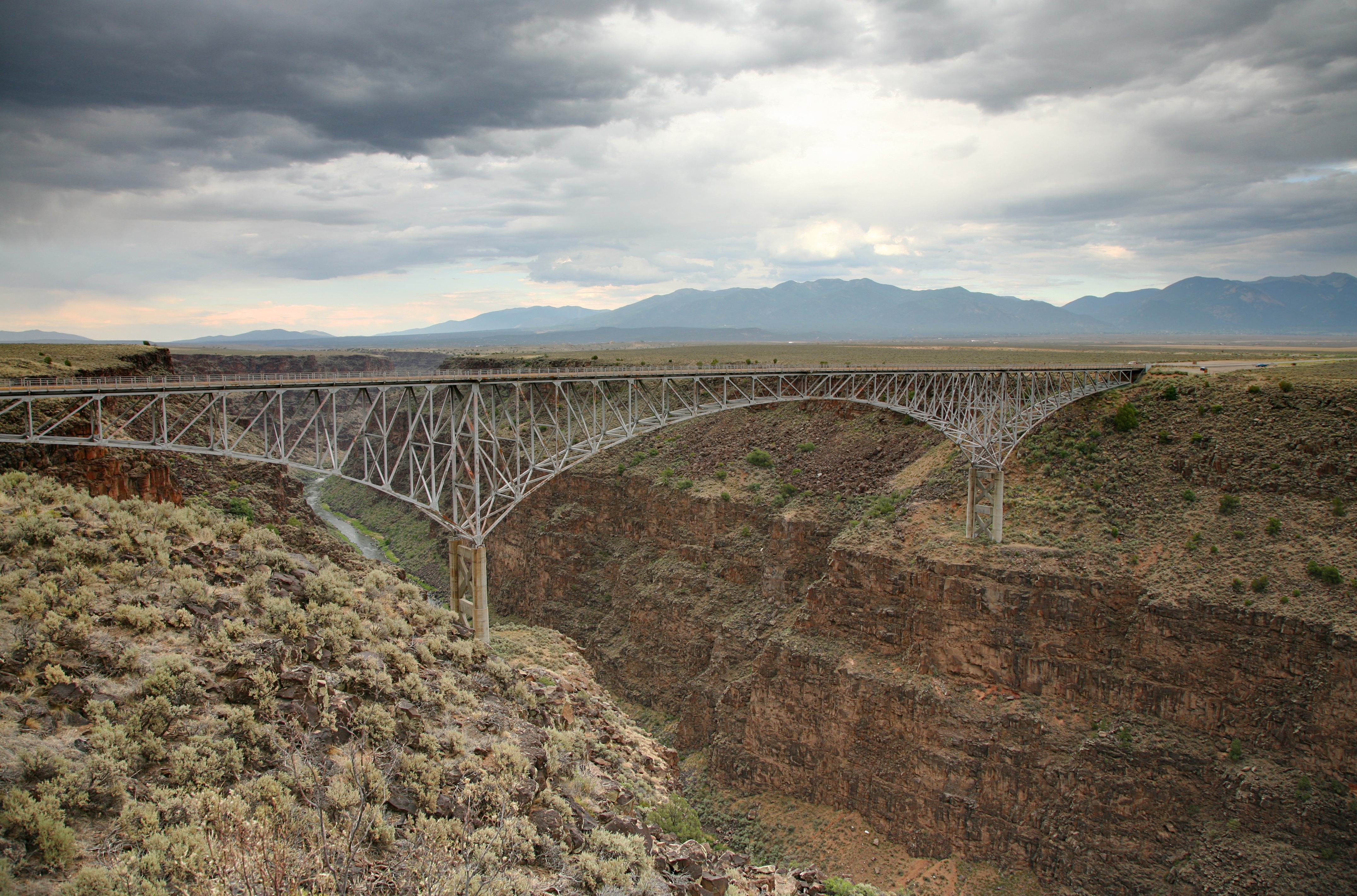
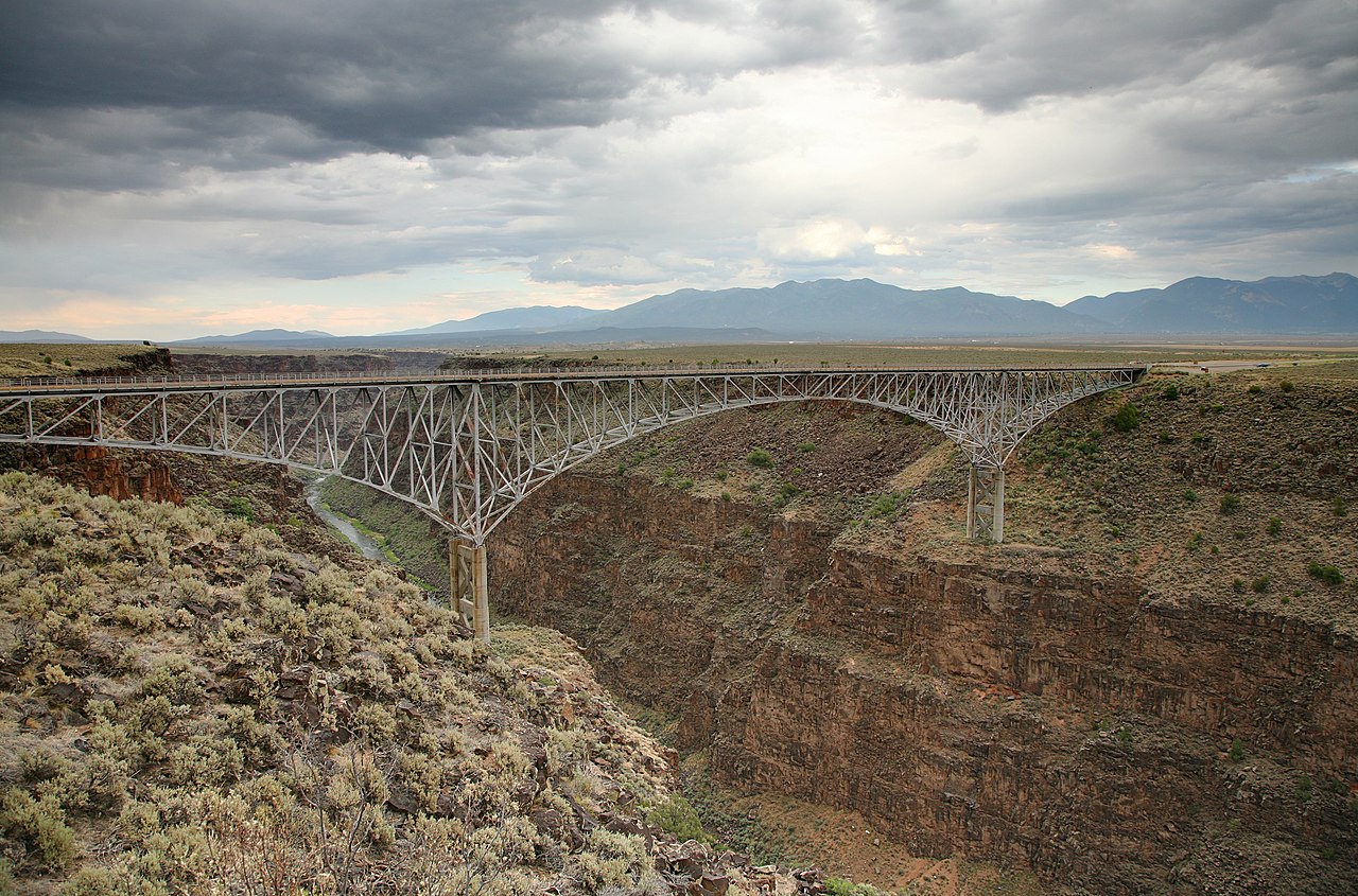
This is an image of a place or building that is listed on the National Register of Historic Places in the United States of America. Its reference number is 97000733. |
| Camera location | | View this and other nearby images on: OpenStreetMap |
|---|
| Coontey |
Deutsch: Bruecke ueber die Schlucht des Rio Grande bei Taos, New Mexico English: U.S. Route 64 Rio Grande Gorge Bridge near Taos, New Mexico. |
| Date | |
| Bun | Own work |
| Author | Daniel Schwen |
| Other versions |
.jpg)
Kieddagh:
I, the copyright holder of this work, hereby publish it under the following license:
This file is licensed under the Creative Commons Attribution-Share Alike 4.0 International license.
- You are free:
- to share – to copy, distribute and transmit the work
- to remix – to adapt the work
- Under the following conditions:
- attribution – You must give appropriate credit, provide a link to the license, and indicate if changes were made. You may do so in any reasonable manner, but not in any way that suggests the licensor endorses you or your use.
- share alike – If you remix, transform, or build upon the material, you must distribute your contributions under the same or compatible license as the original.
| Annotations | This image is annotated: View the annotations at Commons |
This image has been assessed using the Quality image guidelines and is considered a Quality image.
|
Shennaghys y choadan
Crig er daayt/am ennagh son fakin er y choadan myr v’eh ec y traa shen.
| Daayt/Am | Ingin-ordaag | Towshanyn | Ymmydeyr | Cohaggloo | |
|---|---|---|---|---|---|
| bio | 14:46, 13 Jerrey Souree 2010 | | 4,306 × 2,843 (4.58 MB) | Dschwen | {{Information |Description={{de|Bruecke ueber die Schlucht des Rio Grande bei Taos, New Mexico}} {{en|U.S. Route 64 Rio Grande Gorge Bridge near Taos, New Mexico.}} |Source={{own}} |Date=2010-06-25 |Author=Daniel Schwen |Permission=See li |
Ymmyd y choadan
Ta ny 1 duillag eiyrtyssagh kianglt rish y choadan shoh:
Global file usage
The following other wikis use this file:
- Usage on ar.wikipedia.org
- Usage on bcl.wikipedia.org
- Usage on de.wikipedia.org
- Usage on en.wikipedia.org
- Usage on en.wikivoyage.org
- Usage on es.wikipedia.org
- Usage on eu.wikipedia.org
- Usage on fr.wikipedia.org
- Usage on hsb.wikipedia.org
- Usage on it.wikipedia.org
- Usage on it.wikivoyage.org
- Usage on ja.wikipedia.org
- Usage on ml.wikipedia.org
- Usage on nl.wikipedia.org
- Usage on ru.wikipedia.org
- Usage on vec.wikipedia.org
- Usage on www.wikidata.org