Coadan:Map DK.svg

Size of this PNG preview of this SVG file: 465 × 550 pixels. Other resolutions: 203 × 240 pixels | 406 × 480 pixels | 649 × 768 pixels | 866 × 1,024 pixels | 1,731 × 2,048 pixels.
Jeeskeaylley ymlane (coadan SVG, 465 × 550 pixelyn dy ennymagh, mooadys y choadan: 384 KB)
| Coontey |
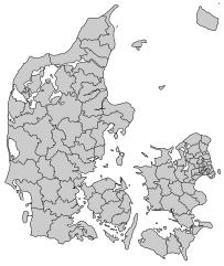
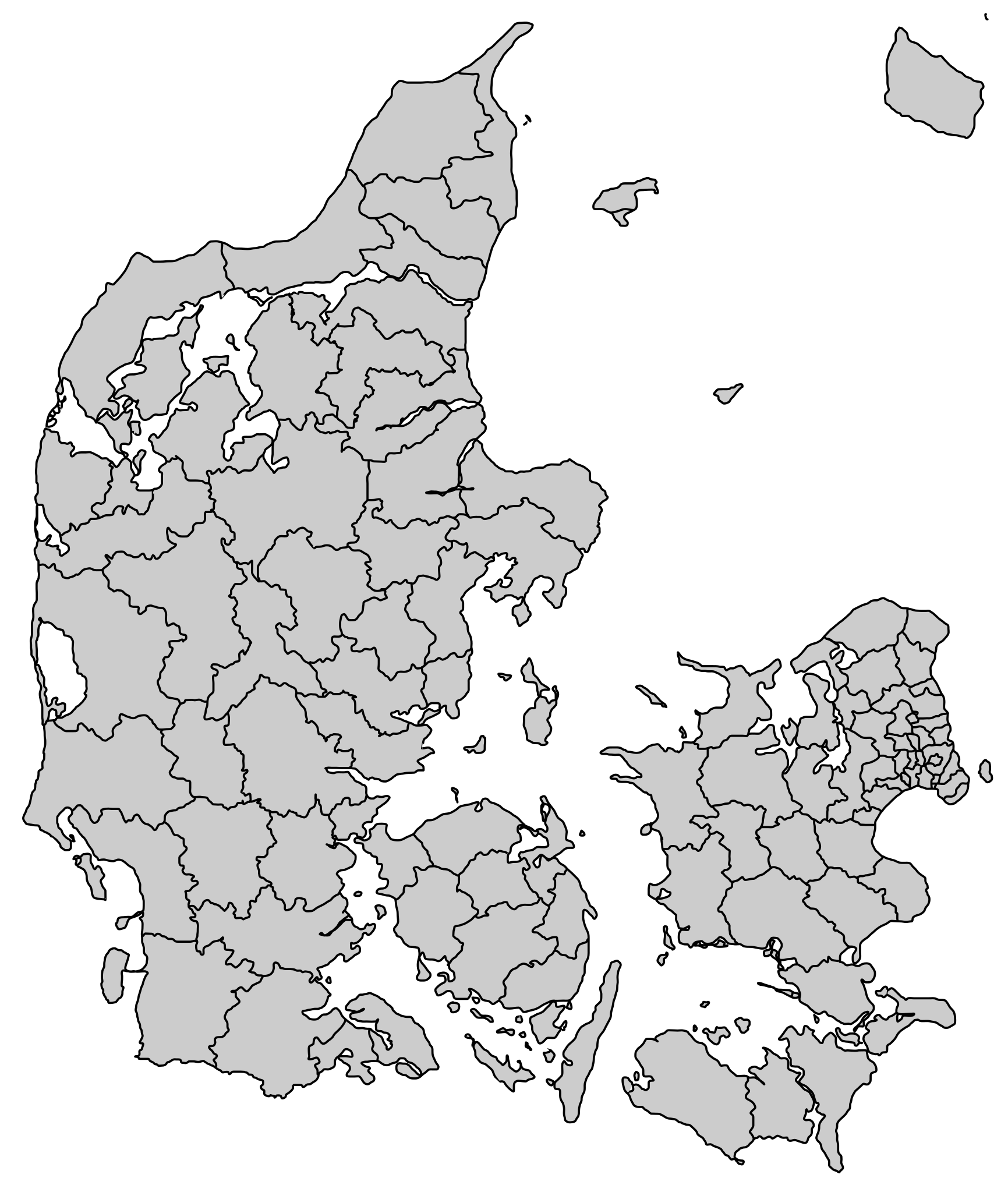
English: Municipalities of Denmark effective January 1 2007.
Deutsch: Dänemarks 98 Kommunen (seit 2007).
Français : Les municipalités du Danemark.
Nederlands: Gemeentegrenzen deense gemeenten (2007).
Svenska: Danmarks kommuner. Notera att placeringen av Bornholm på kartan (längst uppe till höger) inte motsvarar dess placering i verkligheten.
Norsk bokmål: Danmarks kommuner.
Suomi: Tanskan kunnat 1.1.2007 lähtien.
Dansk: Danmark med ny kommuneinddeling per 1. januar 2007 |
||
| Date | |||
| Bun | SVG version of public domain map Image:Map DK.PNG by User:Michiel1972 | ||
| Author | User:Editor at Large | ||
| Permission (Reusing this file) |
|
Shennaghys y choadan
Crig er daayt/am ennagh son fakin er y choadan myr v’eh ec y traa shen.
| Daayt/Am | Ingin-ordaag | Towshanyn | Ymmydeyr | Cohaggloo | |
|---|---|---|---|---|---|
| bio | 03:24, 17 Mee ny Nollick 2018 | | 465 × 550 (384 KB) | A Red Cherry | Corrections to bordering on |
| 18:21, 13 Jerrey Geuree 2007 |  | 465 × 550 (384 KB) | Editor at Large | proper version with fill | |
| 18:19, 13 Jerrey Geuree 2007 |  | 465 × 550 (384 KB) | Editor at Large | Map with fill, as original | |
| 13:08, 12 Jerrey Geuree 2007 |  | 465 × 550 (342 KB) | Editor at Large | version with white background | |
| 13:05, 12 Jerrey Geuree 2007 |  | 465 × 550 (342 KB) | Editor at Large | Location maps of Danish municipalities. SVG rendering of Image:Map_DK.PNG {{PD-self}} Category:Locator maps for municipalities of Denmark |
Ymmyd y choadan
Ta ny 1 duillag eiyrtyssagh kianglt rish y choadan shoh:
Global file usage
The following other wikis use this file:
- Usage on ca.wikipedia.org
- Usage on ceb.wikipedia.org
- Usage on ce.wikipedia.org
- Usage on cs.wikipedia.org
- Usage on da.wikipedia.org
- Usage on de.wikipedia.org
- Usage on en.wikipedia.org
- Aalborg Municipality
- Bornholm
- Allerød Municipality
- Frederikssund Municipality
- Hillerød Municipality
- Hørsholm Municipality
- Albertslund Municipality
- Ballerup Municipality
- Brøndby Municipality
- Dragør Municipality
- Gentofte Municipality
- Glostrup Municipality
- Gladsaxe Municipality
- Herlev Municipality
- Høje-Taastrup Municipality
- Hvidovre Municipality
- Ishøj Municipality
- Lyngby-Taarbæk Municipality
- Rødovre Municipality
- Tårnby Municipality
- Vallensbæk Municipality
- Hjørring Municipality
- Læsø
- Billund Municipality
- Esbjerg Municipality
- Fanø
- Varde Municipality
- Vejen Municipality
- Herning Municipality
- Holstebro Municipality
- Lemvig Municipality
- Struer Municipality
- Køge Municipality
- Lejre
- Solrød Municipality
- Aabenraa Municipality
- Haderslev Municipality
- Sønderborg Municipality
- Tønder Municipality
View more global usage of this file.