Coadan:LocationTrinidadAndTobago.png
Cha nel jeeskeaylley ny smoo ry-gheddyn.
LocationTrinidadAndTobago.png (250 × 115 pixelyn, mooadys y choadan: 6 KB, sorçh MIME: image/png)

|
This locator map image could be re-created using vector graphics as an SVG file. This has several advantages; see Commons:Media for cleanup for more information. If an SVG form of this image is available, please upload it and afterwards replace this template with
{{vector version available|new image name}}.
It is recommended to name the SVG file “LocationTrinidadAndTobago.svg”—then the template Vector version available (or Vva) does not need the new image name parameter. |
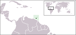
Location map for the Trinidad and Tobago.
Originally created for English Wikipedia by Vardion.
| |
This work has been released into the public domain by its author, Vardion, at the English Wikipedia project. This applies worldwide. In case this is not legally possible: |
Shennaghys y choadan
Crig er daayt/am ennagh son fakin er y choadan myr v’eh ec y traa shen.
| Daayt/Am | Ingin-ordaag | Towshanyn | Ymmydeyr | Cohaggloo | |
|---|---|---|---|---|---|
| bio | 03:12, 20 Mee ny Nollick 2004 | | 250 × 115 (6 KB) | EugeneZelenko | Location map for the Trinidad and Tobago.<br/>Originally created for English Wikipedia by Vardion.<br/>{{PD}}<br/>Category:Country locator maps |
Ymmyd y choadan
Ta ny 1 duillag eiyrtyssagh kianglt rish y choadan shoh:
Global file usage
The following other wikis use this file:
- Usage on als.wikipedia.org
- Usage on ar.wikipedia.org
- Usage on ar.wikinews.org
- Usage on awa.wikipedia.org
- Usage on azb.wikipedia.org
- Usage on ba.wikipedia.org
- Usage on be-tarask.wikipedia.org
- Usage on be.wikipedia.org
- Usage on bg.wikipedia.org
- Usage on bo.wikipedia.org
- Usage on bpy.wikipedia.org
- Usage on bs.wikipedia.org
- Usage on da.wikipedia.org
- Usage on de.wikipedia.org
- Usage on de.wiktionary.org
- Usage on dsb.wikipedia.org
- Usage on en.wikipedia.org
- User:DanielZM/test
- Trinidad and Tobago cuisine
- Biota of Trinidad and Tobago
- List of transcontinental countries
- Area code 868
- User:TheGrappler/North America directory
- List of Trinidad and Tobago–related topics
- Talk:South America/Archive 1
- Portal:Caribbean/Selected cuisine
- Portal:Caribbean/Selected cuisine/5
- LGBT rights in Trinidad and Tobago
- Talk:North America/Archive 2
- Outline of Trinidad and Tobago
- Wikipedia:WikiProject Trinidad and Tobago/Index of Trinidad and Tobago–related articles
- Environment of Trinidad and Tobago
- Portal:Trinidad and Tobago
- Portal:Trinidad and Tobago/Intro
- Colonization attempts by Poland
- List of non-marine molluscs of Trinidad and Tobago
- List of scorpions of Trinidad and Tobago
- List of Opiliones of Trinidad and Tobago
- List of mantids of Trinidad and Tobago
- Usage on en.wikivoyage.org
- Usage on eo.wikipedia.org
- Usage on eo.wiktionary.org
- Usage on es.wikipedia.org
View more global usage of this file.