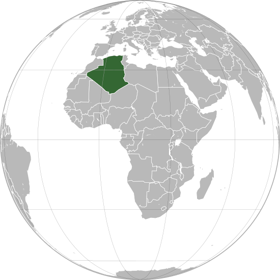
Coadan:Algeria (orthographic projection).svg

Size of this PNG preview of this SVG file: 550 × 550 pixels. Other resolutions: 240 × 240 pixels | 480 × 480 pixels | 768 × 768 pixels | 1,024 × 1,024 pixels | 2,048 × 2,048 pixels.
Jeeskeaylley ymlane (coadan SVG, 550 × 550 pixelyn dy ennymagh, mooadys y choadan: 218 KB)
Shennaghys y choadan
Crig er daayt/am ennagh son fakin er y choadan myr v’eh ec y traa shen.
| Daayt/Am | Ingin-ordaag | Towshanyn | Ymmydeyr | Cohaggloo | |
|---|---|---|---|---|---|
| bio | 17:22, 27 Mee ny Nollick 2022 |  | 550 × 550 (218 KB) | M.Bitton | Reverted to version as of 13:25, 1 March 2021 (UTC): per COM:OVERWRITE + a centered version already exists |
| 14:41, 24 Mee ny Nollick 2022 |  | 2,048 × 2,048 (1.25 MB) | Takiva | . | |
| 13:25, 1 Mayrnt 2021 |  | 550 × 550 (218 KB) | Trần Nguyễn Minh Huy | Reverted to version as of 13:22, 2 April 2013 (UTC) missing South Sudan | |
| 07:31, 28 Toshiaght Arree 2021 |  | 550 × 550 (281 KB) | Trần Nguyễn Minh Huy | fix scheme | |
| 13:22, 2 Averil 2013 |  | 550 × 550 (218 KB) | Chipmunkdavis | Fixing Moldova, Lebanon, Israel, deleting extra layer of borders | |
| 20:47, 3 Toshiaght Arree 2013 |  | 550 × 550 (186 KB) | Chipmunkdavis | Removing solid fill from the borders so the lakes can be seen | |
| 04:31, 7 Averil 2012 |  | 550 × 550 (186 KB) | Chipmunkdavis | Egyptian and Kenyan administrative borders | |
| 16:10, 14 Mean Fouyir 2011 |  | 550 × 550 (186 KB) | Chipmunkdavis | Centreing | |
| 11:08, 12 Jerrey Souree 2011 |  | 550 × 550 (187 KB) | Marquinhos | Added border Sudan-South Sudan. | |
| 13:13, 3 Jerrey Geuree 2011 |  | 550 × 550 (281 KB) | Martin H. | Reverted to version as of 22:15, 13 January 2010 |
Ymmyd y choadan
Ta ny 1 duillag eiyrtyssagh kianglt rish y choadan shoh:
Global file usage
The following other wikis use this file:
- Usage on ace.wikipedia.org
- Usage on af.wikipedia.org
- Usage on ami.wikipedia.org
- Usage on ar.wikipedia.org
- Usage on avk.wikipedia.org
- Usage on azb.wikipedia.org
- Usage on az.wiktionary.org
- Usage on bg.wikipedia.org
- Usage on bh.wikipedia.org
- Usage on bi.wikipedia.org
- Usage on bn.wikipedia.org
- Usage on bug.wikipedia.org
- Usage on ca.wikipedia.org
- Usage on cbk-zam.wikipedia.org
- Usage on cdo.wikipedia.org
- Usage on ceb.wikipedia.org
- Usage on chr.wikipedia.org
- Usage on cs.wikipedia.org
- Usage on dag.wikipedia.org
- Usage on da.wikipedia.org
- Usage on da.wiktionary.org
- Usage on en.wikipedia.org
- Usage on en.wikinews.org
- Usage on en.wiktionary.org
- Usage on es.wikipedia.org
- Usage on fr.wikipedia.org
- Usage on gcr.wikipedia.org
- Usage on gu.wikipedia.org
- Usage on hak.wikipedia.org
- Usage on hi.wikipedia.org
- Usage on hr.wikipedia.org
- Usage on hy.wikipedia.org
- Usage on id.wikipedia.org
- Usage on ie.wikipedia.org
- Usage on ilo.wikipedia.org
View more global usage of this file.