Coadan:Isle of man satellite image.JPG

Size of this preview: 800 × 593 pixels. Other resolutions: 320 × 237 pixels | 640 × 474 pixels | 992 × 735 pixels.
Jeeskeaylley ymlane (992 × 735 pixelyn, mooadys y choadan: 77 KB, sorçh MIME: image/jpeg)
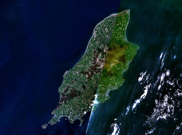
Isle of Man satellite image
| This image is in the public domain because it is a screenshot from NASA’s globe software World Wind using a public domain layer, such as Blue Marble, MODIS, Landsat, SRTM, USGS or GLOBE.
|
 |
Shennaghys y choadan
Crig er daayt/am ennagh son fakin er y choadan myr v’eh ec y traa shen.
| Daayt/Am | Ingin-ordaag | Towshanyn | Ymmydeyr | Cohaggloo | |
|---|---|---|---|---|---|
| bio | 23:58, 23 Mayrnt 2006 | | 992 × 735 (77 KB) | Roke~commonswiki | Isle of Man satellite image {{PD-WorldWind}} Category: Isle of Man |
Ymmyd y choadan
Ta yn 2 duillag eiyrtyssagh kianglt rish y choadan shoh:
Global file usage
The following other wikis use this file:
- Usage on en.wikipedia.org
- Usage on es.wikipedia.org
- Usage on fr.wikipedia.org
- Usage on it.wikipedia.org
- Usage on pl.wikipedia.org
- Usage on pl.wiktionary.org
- Usage on www.wikidata.org