Coadan:Bretagne Finistere PointeduRaz15119.jpg
Size of this preview: 800 × 600 pixels. Other resolutions: 320 × 240 pixels | 640 × 480 pixels | 1,024 × 768 pixels | 1,280 × 960 pixels | 2,304 × 1,728 pixels.
Jeeskeaylley ymlane (2,304 × 1,728 pixelyn, mooadys y choadan: 1.66 MB, sorçh MIME: image/jpeg)
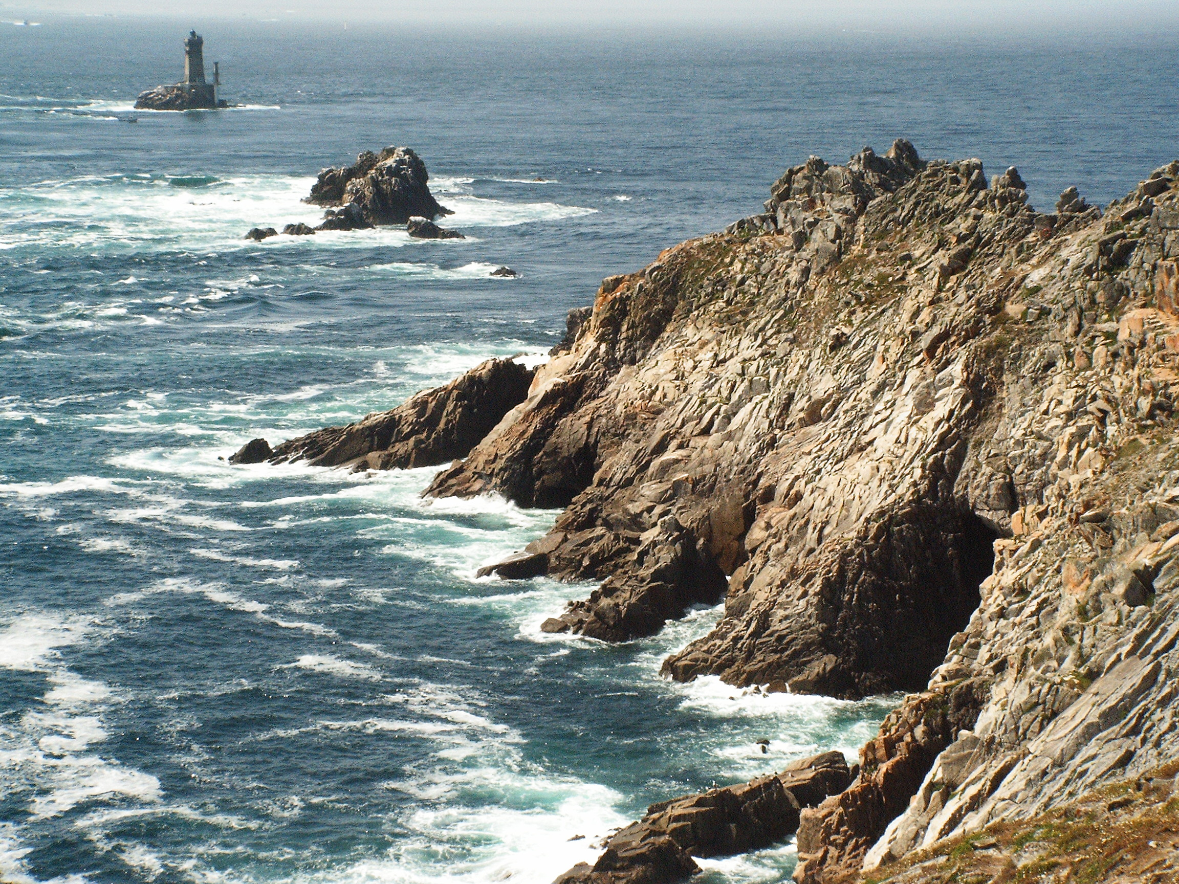
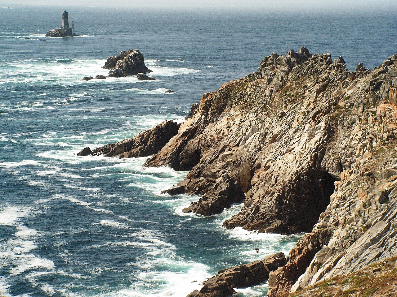
| Coontey | Felsformationen am Pointe du Raz in der Bretagne |
| Date | |
| Bun | Self-photographed |
| Author | S.Möller |
| Object location | | View this and other nearby images on: OpenStreetMap |
|---|
| This work has been released into the public domain by its author, S.moeller. This applies worldwide. In some countries this may not be legally possible; if so: |
| Annotations | This image is annotated: View the annotations at Commons |
Shennaghys y choadan
Crig er daayt/am ennagh son fakin er y choadan myr v’eh ec y traa shen.
| Daayt/Am | Ingin-ordaag | Towshanyn | Ymmydeyr | Cohaggloo | |
|---|---|---|---|---|---|
| bio | 07:50, 29 Jerrey Souree 2005 | | 2,304 × 1,728 (1.66 MB) | S.moeller | '''Description:''' Felsformationen am Pointe du Raz in der Bretagne '''Source:''' Selbst fotografiertes Bild [S.moeller](Juli 2005) '''Date:''' 21.07.2005 '''Author:''' [S.moeller] '''Permission:''' Die Datei ist gemeinfrei |
Ymmyd y choadan
Ta ny 1 duillag eiyrtyssagh kianglt rish y choadan shoh:
Global file usage
The following other wikis use this file:
- Usage on als.wikipedia.org
- Usage on ast.wikipedia.org
- Usage on bn.wikipedia.org
- Usage on br.wikipedia.org
- Usage on ca.wikipedia.org
- Usage on de.wikipedia.org
- Usage on de.wikivoyage.org
- Usage on el.wikipedia.org
- Usage on en.wikipedia.org
- Usage on en.wikibooks.org
- Usage on en.wikiversity.org
- Usage on eo.wikipedia.org
- Usage on es.wikipedia.org
- Usage on eu.wikipedia.org
- Usage on fr.wikipedia.org
- Usage on fr.wikivoyage.org
- Usage on fr.wiktionary.org
- Usage on fy.wikipedia.org
- Usage on id.wikipedia.org
- Usage on incubator.wikimedia.org
- Usage on it.wikipedia.org
- Usage on ja.wikipedia.org
View more global usage of this file.